


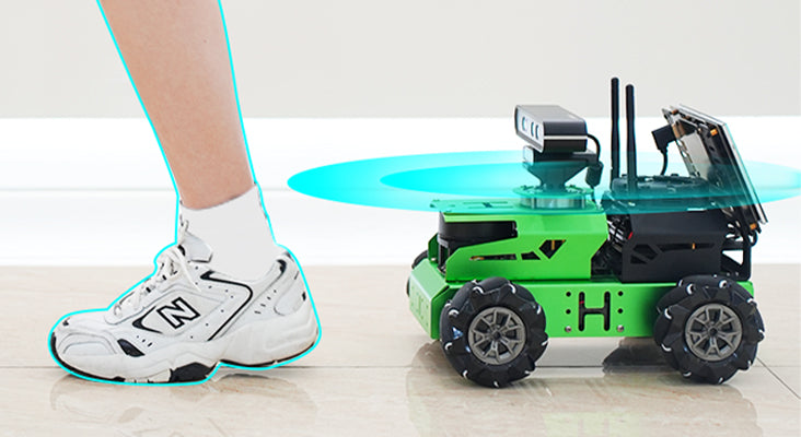
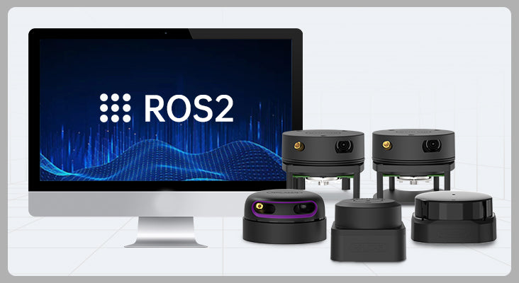
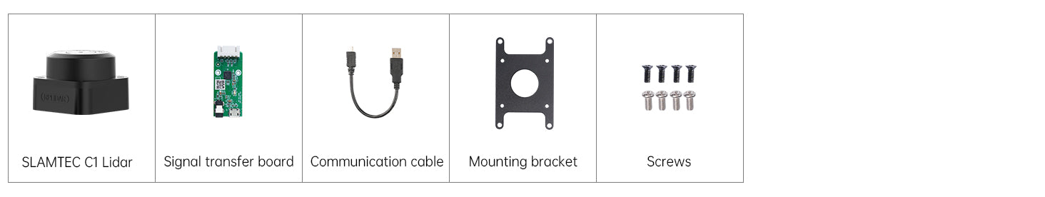
SLAMTEC RPLIDAR Lidar C1 A1 A2M12 S2L SLAM Triangulation Ranging Support Mapping Navigation for ROS/ROS2
- Design for ROS robot mapping and navigation
- 360° scanning, high frequency ranging, long ranging radius
- Support Windows, Android, ROS, Linux systems
- Provide SLAMTEC official learning materials
- Meet FDA Class 1 safety standard


Triangulation Laser Ranging
Laser triangulation is a ranging technique that involves directing a laser beam at a target surface at a specific angle. The laser beam is then reflected and scattered by the target surface. A lens is used to converge the reflected laser beam at another angle to form an image of the light spot on a position sensor called a CCD (Charge-coupled Device).

TOF Laser Ranging
Time of Flight (TOF) ranging method guarantees that Lidar ranging accuracy is not affected by distance. This means that even when ranging over long distances, TOF Lidar can still achieve precise and stable ranging.
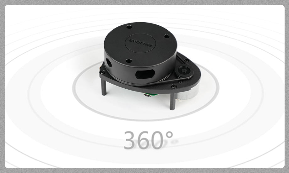
360° Omnidirectional Scanning
The ranging core of RPLIDAR Lidars run clockwise to perform 360 degree omnidirectional laser ranging and scanning to generate an outline for the environment.


RPLIDAR Sampling Rate

RPLIDAR Ranging Radius

RPLIDAR Scanning Frequency

Support Windows Environment

Compatible with Multiple Controllers

Support Multiple Robots


| Item | Specification |
| Ranging principle | C1/ S2L: Time-of-Flight(TOF) A1/ A1 upgraded / A2M12: Triangulation |
| Ranging radius | C1: 12m A1/ A1 upgraded version: 0.15m - 12m A2M12: 0.2m - 12m S2L: 0.05 - 18m |
| Ranging frequency | C1/ A1/ A1 upgraded version: 8000Hz A2M12: 16000Hz S2L: 32000Hz |
| Scanning frequency | C1: 8Hz and 12Hz(adjustable) A1: 5.5Hz A1 upgraded version: 5.5Hz and 10Hz (adjustable) A2M12: 10Hz S2L: 15Hz |
| Scanning angle | 0 - 360° |
| Angle resolution | C1: 0.72° A1/ A1 upgraded version: ≤1° A2M12: 0.225° S2L: 0.12° |
| Sample rate | C1: 5k A1/ A1 upgraded version: 8k A2M12: 16k S2L: 32k |
| Communication rate | C1: 460800bps A1/ A1 upgraded version: 115200bps A2M12: 256000bps S2L: 1M |
| Operating scene | C1/ S2L: Indoor/outdoor A1/ A1 upgraded / A2M12 : Indoor |
| Dimension | C1: 55.6*55.6*41.3 mm A1: 96.8*70.3*55 mm A1 upgraded version: 96.8*70.3*58 mm A2M12: 76*41 mm S2L: 77*77*38.85 mm |
| Supply current | C1: 230mA A1/ A1 upgraded version: 100mA A2M12: 450mA - 600mA S2L: 400mA |
| Power consumption | C1:1.1-4.16W A1/ A1 upgraded version: 0.5W A2M12: 2.25W-3W S2L: >2W |
| Output | UART serial port (3.3V level) |
| Operating temperature | C1: -25℃ - 40℃ A1/ A1 upgraded / A2M12: 0℃ - 40℃ S2L: -10℃ - 50℃ |
| Ranging accuracy | C1/ S2L: ±3cm A1/ A1 upgraded / A2M12 : 1% of the range (≤3m); 2% of the range (3 - 5m); 2.5% of the range (>5m) |
| Support | ROS1/ ROS2 |
| Supply voltage | 5V |
Shipping & Delivery
1. Free Shipping Policy
Hiwonder offers free standard shipping on orders over US $499 (before tax and duties), delivered via trusted carriers such as DHL, UPS, or FedEx.
Most orders arrive within 6 working days after dispatch. You can check if your country is eligible for free shipping in the regions listed below.
Eligible Regions
- Americas: United States, Canada, Mexico, Chile
- Europe: Germany, United Kingdom, Netherlands, Switzerland, France, Austria, Italy, Belgium, Spain, Sweden, Finland, Norway, Portugal, Czech Republic, Poland, Greece, Slovenia, Romania, Denmark, Bulgaria, Luxembourg, Slovakia, Hungary, Ireland, Estonia, Lithuania
- Asia: China, Japan, Singapore, South Korea, United Arab Emirates, Malaysia, Thailand, Philippines, Indonesia
- Oceania: Australia, New Zealand
If your country or region is not listed above, the shipping cost will be automatically calculated at checkout once you enter your shipping address.
2. Customs & Import Fees
All international shipments are subject to local customs regulations. Import duties, taxes, or other fees may be charged by your country's customs authority upon arrival.
Our shipping term is FOB Shenzhen, which means these fees, if any, are the customer's responsibility. The shipping carriers will assist with the customs clearance process to ensure smooth delivery.
If a package is returned due to unpaid customs duties, any related return or reshipping fees will be deducted from your refund.
3. Order Processing Time
Orders are typically processed within 24 hours after placement and shipped the next business day.
Orders placed on weekends or public holidays will be shipped on the next working day.
Once shipped, you will receive a confirmation email with tracking information.
Questions & Answers
Have a Question?
-
could you please provide me a quotation for SLAMTEC RPLIDAR Lidar C1 A1 A2M12 S2L SLAM with shipping cost and taxes.
Hello,
Could you kindly share your order list and the quantity you require with us at support@hiwonder.com? Our sales team will be happy to provide you with a quotation. Thank you!
-
What is the complete equipment to use a rplidar c1 with the map nav android app. I don't know how to program in ROS so I need apps already made ready to work. Does the windous application output angle and distance data in txt or csv format? .The same for the MS200..what app is there for android and for windows.thanks
Sorry, this Lidar cannot be controlled by app


 with Precision Depth Camera & LiDAR for Robot Programming")
 with Precision Depth Camera & LiDAR for Robot Programming")

